Search This Blog

Sunday, December 8, 2013

Cartagena

After 5 days of exploring Cartagena, we have found it to be a fascinating place.  Leaving out the death defying street crossings, we have enjoyed it, lots of history here.   We have walked the fort walls and visited the forts and several museums.  Done some shopping and lots of walking around the city.  Also some great beaches here if your into that. 

      Our oldest solar panel failed and I managed to source one in Cartagena and hope to take delivery of it Monday. Got a 90 watt panel for 345,000Pesos or a bit less than $200 dollars, very reasonable.   Then Tuesday we hope to leave and visit a couple of the outer Columbian islands, nearby.  Then head for the San Blas islands of Panama.  There is not much civilization in the San Blas so we may be out of internet service and no blog updates until near end of December or start of January.

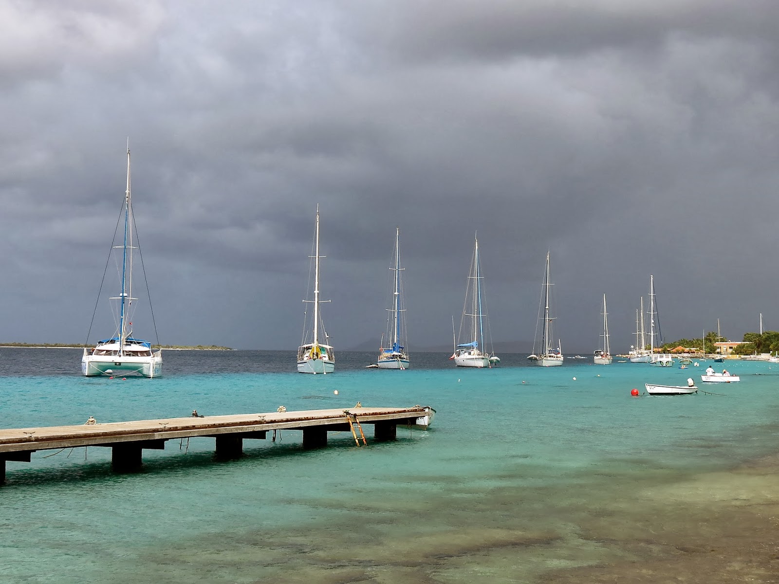
   Dec 11 we left Catagena and motored  out the main ship channel as this was on our way.  We motored by the main forts guarding the entrance to the harbour, but had to pause briefly to allow a ship through the narrow entrance.  Then we scooted out on his tail before another ship came in.  We sailed part of the 18 miles to Isla Grande and planned to anchor but the bottom looked terrible with huge chunks of corral and we did not want to snag our anchor or chain.  Then we noticed a couple of buoys near by and if we interpreted the spanish correctly they were park bouts.  They had a nice thick rope so we tied up.  If they dragged we would just drift out to sea.
   I then jumped in the nice clear water to clean propellor and found it completely covered in a 1/4 inch layer of barnacles, this was all from 10 days in Cartagena.
  The next morning we dinghyed to shore to look around.  A local showed us a large cage full of macaws and Toucans.  When we returned to the beach where we left our dinghy, we saw the engine was gone.  Stolen!  The local guy with us asked a few other people around and soon there was about 8 people involved and one guy found the engine hidden up in the bushes 50 meters up the beach. Whew, we got it back and it was okay.   We then left for the island of Tintpan about 25 miles away


INFO

-Anchorage at Isla Grande, mooring balls at 10 10.17N   75 45.04W and is two balls. About 18 miles W of Cartagena,  water very clear and lots of fish under boat.

-Anchorage at Tintipan anchored in 28ft at 09 47.310N   75 50.180W again very clear water here

-It is much hotter in Cartagena than Santa Marta and a lot less wind.  We never seem to get more than 12 to 15 knots in the anchorage, and from different directions.  (December)

-Before leaving the ABC'c we had read a lot of the info available on visiting Columbia.  A lot of it, I think gives you a wrong impression.  We almost did not take the boat to Cartagena going by stuff we read, and that would be a mistake.
      Perhaps some of the stuff written is by people who have only cruised the Carribbean or have just come from a big city in the states.  In Hindsight now we are glad we took the boat to Cartagena and did not just make a bus visit from Santa Marta, especially since we had to come this way anyway.   It is no hassle to clear in, just a few minutes with the agent and they do everything else.   The anchorage here is fine, I don't know what it is like in the wet season, but certainly it is fine now in the dry season. (starts Dec 1).  We have seen many places a lot worse on our trip around the world.  For a emerging third world country, it is much cleaner that many we have seen.  To visit from Santa Marta by bus would be much more expensive.  As the only costs here was the extra $70 dollars for the agent and a small dinghy dock fee.

-Club Nautico, where we are anchored, is still under renovation as of Dec 6 2013.  They take forever I here.  Maybe it will be finished by Christmas or maybe a few more months??  We get all the water we want and garbage removal for our dinghy dock fee, which is reasonable.  See last post for costs. It will be nice once the showers are working.   You can walk almost anywhere here or take a cheap taxi.  We have not taken a taxi yet here, just walk everywhere.  

-For internet we got a sim card for our old usb dongle and it works fine in the anchorage, though a bit slow.  For a week it was $15.00 for data for a week and $10 for the sim card.  Got this from a street vendor across from the nearby grocery store.

-My Solar Panel  I got from Energias Alternas  and Fernando was the contact who speaks perfect english.  He seems to have access to a wide variety of panels.  He does not have a store, but a office at Calle Larga #8B  55 of 103 Is a 25 min walk from anchorage.
    email:  fernando@energiasalternas.com.co   313 624 8977   0r  313 585 2214
      Note: This added later, we never did get delivery of the solar panel.  His two days turned into 3 days then 4 days and finally we had to leave and another yacht tried for us emails from both sides bounced so if want a panel here probably have to stay on Columbia time and allow lots. Will try Panama for a panel.


Gold artistry of the Zenu culture, which dates back to the second century BC. The Zenus inhabited a large part of northern Columbia until the arrival of the Spaniards in the 1500's.
We visited Gold Museums in both Santa Marta and Cartagena. Amazing intricate work.
Overlooking the city from San Felipe de Barajas Fort.
One of the guard stations at The Fort.
San Felipe de Barajas Fort is the largest fortress built in America by the Spanish Empire. Really impressive.
Thought this sculpture must have been done especially for us cruisers. Mexican train dominoes is a regular Sunday afternoon social event.
There is a whole bunch of these metal sculptures/artwork around the old city, thought this one was cute.

Saturday, December 7, 2013

One of the San Pedro Claver church windows.
San Pedro Claver church, named after the first saint to be canonized in the New World.
Old town Cartegena has been beautifully restored. Very pleasant to wander around the streets.
Entrance to the old city of Cartegena
Cartegena's wall of white. View of the city as we approach by sea.

Monday, December 2, 2013

Arrival in Cartagena

Passage weather and Buoy weather was showing 18 to 21 knots for our area and we decided to leave Santa Marta Saturday morning.  I was thinking we should wait until Sunday for the winds to ease a bit, but we already had our departure zarpe and also the marina gets very noisy Saturday nights, in the end we decided to leave decision until Saturday morning.  Saturday morning we were up at 5:30am and there was a somewhat strong wind still blowing through the marina but we decided to go for it.  Jimmey Cornells world cruising guide says world sailors often find the passage along this coast to be among the worst in the world.  
     We had a bit of trouble getting of the dock with the wind blowing, and almost hit another boat before we finally got under way.   Out in the bay it was blowing 20 to 25 knots and then eased some as we left Santa Marta behind and we thought, nice we were in for a pleasant passage or so we thought, it actually turned into one of our 5 worst passages ever.
       After an hour the winds started to increase and soon it was blowing over 30 knots, then 35 and I had 3 reefs in our main.  Then the wind increased to 40 knots at times and occasionally a wave braking behind us would have spray blown of it into the cockpit. We also shipped a lot of water over the sides when we occasionally did a deep roll as the waves were on the stern quarter and not directly behind us. Our little 36 footer  has always tended to get water on decks easier than most boats. I eventually put our 4th reef in which we have only used once before, and all the head sail in except for the 2ft going out to our running pole still in place.  We were still doing 6 to 7 knots in seas that were very close together and steep.
      Our plan was to do the 110 miles to Cartagena over two days and spend the night at a anchorage about half way.   As we neared the Magellina river, which is about 14 miles from our intended anchorage,  the wind eased a bit to about 30 knots.  We could see the condo hi-rises of Baranquilla in the distance.  We rounded the headland where the river comes out about 4 to 5 miles offshore, the water turned a dark brown from the river outflow.  There is a reputation of junk coming down the river, but we saw no trees, dead cows or bodies,  we saw nothing but one tiny tree branch, perhaps because it had not rained much lately.   The sea state did not get any worse because of river, and  conditions eased a bit more as we rounded the headland.    The wind dropped down to 20 to 25 knots and we had a good sail to Punta Hermoso where we intended to anchor.  We motored around point and into bay which was still windy but had no sea state.  
     We motored up bay and anchored behind the only other yacht anchored out, and this was just across from the new marina.  Hook down about 5pm.   A navy launch followed us up bay and after we anchored came along side us and two men came aboard and checked our papers and filled out a couple of forms.  The other person went below for a quick look.  They were all polite and professional.
    
    Even though the wind blew hard for part of the night, we had a great sleep here and left at 6am in the morning to do the remaining 50 miles to Cartagena.   The wind started out in the 20 knot range but in a hour it was up to 25 knots from NE and we had a  rough sail again for a few hours until we rounded a major headland and started heading more South and then the wind and seas eased and as we neared Catagena the wind was down to 12 to 15 knots.  We ended up motor sailing the last 10 miles so we would get in at a good time.
   We took the Northern small craft entrance into the city which is much shorter.  As we motored between the two red/green buoys the water briefly got down to 11 feet for a few seconds, which caused a bit of worry but then it got deeper again.  The city is huge, hi-rise condos everywhere.  As we motored into our anchorage 20 minutes later we were surrounded buy huge office towers, and condos, also navy ships tied to docks and container ships on other side.  It is a stunning backdrop.  This was Sunday afternoon and the there were constantly speedboats and tour boats going buy.  The water did not appear to be as dirty as people had said.  We dropped anchor around 4:30pm and cleaned up the boat and then relaxed, we would deal with our check-in in the morning.
    
     Next morning we dinghied over to say hello to the Mojombo's and to pump them for information on the local scene.   Then we dinghied  over to club Nautico and payed our dinghy landing dock  fee of 58000 pesos for a week and this includes garbage and water.  Then they called up the agent suggested by our Santa Marta agent  to come and clear us in and then we were free to explore the city. 

INFO

- About 1900 peso's to a dollar

-Left Santa Marta Nov 30 2013

-We noticed no adverse currents  along our route to Cartagena, and possibly a favourable current for part of the way.   Talking to other yachts and our own experience, it seems the stretch of coast around Santa Marta to Baranquilla (or Magallena river) has its own local conditions and the winds are typically 15 knots or more stronger than forecast, so 20 knots forecast may turn out to be 35 to 40 knots in reality.  Probably want to leave Santa Marta on a light wind forecast.

-Rounding the headland with the Magallena river was a non issue, no problem in the strong winds we got and we were 4 to 5 miles off shore, the sea-state did not get any more difficult.   Also saw no debris in water, but water colour was muddy.  Though we were getting into the dry season.  We did see a big log and scattered tree branches a few miles South of Punta Hermosas bay, the next day on our way to Cartagena. 
     Both us and another yacht we talked to that rounded a week earlier  in similar conditions, found the winds eased as we neared the headland with the Magellena river.

-Anchorage at Punta Hermoso is 60 miles from Santa Marta.  The sandpit that forms the bay extends quite a bit further than the chart shows.  Use this waypoint for turning in 10 56.07N   75 03.22W I got this from another writeup and it worked fine, lots of water under keel.  Then we anchored in 24 feet at 10 56.44N   75 02.41W.
    This is not necessarily the best spot to anchor, the head of bay may be better, but it was fine for us and even though wind got up to 30 knots during night, the chop and boat motion was fine and holding excellent.  A great anchorage and room for a 100 boats, nothing  much in here and it is half way between Santa Marta and Cartagena.   We never checked out the new marina, there was about 10 yachts in it that we could see.  Marina is called Marina Puerto Velero.
    
-We stayed on the edge of the bank marked on charts has we headed south from Punta Hermoso to avoid the heavy ship traffic, and were in 50 to 60 feet of water.

-As we neared Cartagena we took the small craft entrance to city.  Use waypoint 
   10 23.4N   75 34.4W as initial approach until you can see the two red and green bouys that you go between.  The water depth shallowed to 17 to 25 feet and then as you go between the bouys drops to about 11 feet for a second or two then gets deeper again. After that is easy to get to anchorage near club Nautica
   We anchored in 47 feet at 10 24.46N   75 32.50W

-Clearing in.   Turns out our agent did a good job in Santa Marta because we had no paper work issues.  The Cartagena Agent "David" showed up 15 minutes after being called and he had good English.  His phone # 313-523-0742 and he charged us 140,000 pesos or about $70.00 to finish our clear in and for our exit zarp later.  He charged less since we had done most of the paper work in Santa Marta.  So our total paper work expenses was $220 plus $70 or $290.  Expensive if you only staying about 3 weeks, like us, in the country.  But with this fee we were good for 3 months at least and we have the paper work to visit the outer islands as well.

-Provisioning in Columbia.  We have noticed the selection of canned goods is very small compared to anywhere else. So good to stock up ahead of time.  The prices of groceries is not too bad, similar to the ABC's and some things cheaper.  Fresh fruit and veggies are often very cheap. 

_Cartagena is a World Heritage site and seems pretty clean compared to Santa Marta.  The water in the anchorage is not too bad, definitely cleaner than Chagaramas in Trinidad.  I think people sometime mistake the discolouration of river outflow into a harbour for polution.


Exploring Santa Marta and Getting Ready to Leave


    We have been in Columbia about ten days now and found it a interesting place with its own culture, unlike the ABC's 
The main annoyance is the clearing in process, probably the slowest of any country we have visited.  You have to have an agent and we tried to get the Romovela agency but neither of the email addresses we had worked and when we asked for them on arrival at Santa Marta, the marina gave us someone Called Jose.  He is nice enough, but his english is almost non existent.  After ten days we have accumulated 4 pieces of paper to do with the clear in process.  We are not sure if we are fully cleared in or not.  It's the agent that makes everything take so long I believe.  After about three days here he brought out the customs agent onto our boat to fill out some forms.
      Today, which is Wednesday, we happened to see the agent in the yard here and we told him we would like to clear out and have everything done by Friday as we wish to leave early Saturday morning.  We brought him into the marina office and got the english speaking clerks here to translate for us to make sure he understood.  So we shall see what happens.  

      During our last ten days here we have done lots of exploring.  We took a jeep ride up to Minca, a tiny little village in the foothills at about 2500ft elevation.  Once there we did a half day hike with an organized tour.  There was two other couples from Australia on the hike with us, though they were much younger.    The hike was a circular route up to a waterfall, and the route there was up a trail a bit but mostly up the creek bed where we had to wade thigh deep up the rapidly flowing creek and balance on slippery boulders.  Coming back was an easy trail and then on the road.  Then we had an included lunch and then walked over to a coffee plantation and a place with a great view of a valley with many humming birds.
    We also did bus trips to towns on either side of Santa Marta  which are more touristy.  Also did lots of exploring of Santa Marta.   Very little English spoken here so having a translator or phrase book is great.  We have a Spanish/English translator on our smart phone which is handy.
   Another night we watched a display of fireworks not  far from where we are docked.  They also turned on all there Christmas display lights that they had been putting up the last week.
    
  On Saturday, winds permitting, we are planning to do the 110 miles to Cartagena over two days, with an overnight stop at Punta Hermosa.  The anchorage in here is suppose to be good.  So there is no overnight passage to do, which is good as the winds at night seem to often increase to very strong, and we have often noticed that even in the marina.  The last few nights have been very windy here at night.  The wind seems to pickup after dark and die some after daylight. Sometime is around 30 knots at night, probably a lot stronger out at sea.  Santa Marta to Baranquilla area is know for very strong local winds, often over 40 knots.  
    Our agent finally arrived with our departure zarpe for Cartagena at 7pm tonight and we are hoping to leave tomorrow morning.  He gave us 3 more pieces of paper making a total of 7.  We will find out in Cartagena if he has done the paper work correctly. 

INFO
-Try to get Dino for an agent in Santa Marta, as he has better english and people seem happy with him.  Ask for him as at Marina office as soon as you arrive.  Our agent we got given to use was Jose, he charged us a total of $220 dollars for everything.   His fee was $120 and then $100 for a permit and we could stay up to 3 months or a year for this, not sure as we don't plan to stay in Columbia more than 3 weeks.
     Note: In hindsight he did everything right and his fees were comparable to anyone else.  The only hassle was trying to communicate with him.  


Friday, November 29, 2013

Merry Christmas from Columbia
No Frosty or Rudolf decorating the streets here. Christmas lights mostly in shapes of various sea life.
Christmas lights in Santa Marta
Traditional living accommodations.
Coffee ready for picking. They were picked manually on this small organic farm. Best coffee we've ever tasted.
Getting the coffee beans ready for drying
Old church in Santa Marta and handcrafted bags are sold by street vendors and shops.
Grown in Columbia
Aruba Architecture

Tuesday, November 19, 2013

Arrival in Santa Marta Columbia


After a few days in Aruba we checked the weather and saw a change coming up. The winds have been strong the last few days and we could see it was starting to ease and then the wind was going to drop to very low for a few days.   We did not want to motor the 255 miles to Santa Marta our next destination.   So we decided to leave Saturday morning.   
   We cleared out with customs and immigration.  We took a bus down and walked last bit, and then were going to walk back.  I had asked the officials when we cleared in if we needed to bring our boat back to Bacadera to clear out and they said no.  But while we were clearing out they asked where our boat was and that we were to bring the boat here to clear out. I was very annoyed at this and he relented and said okay but next time.  It was very windy that day and it would be very difficult to go up against wind and waves to get to Bacadera.   This alone could be a reason to skip visiting  Aruba, for a small sailboat.  The inside route is supposedly not safe if you don't know the area.  On the walk back a car soon stopped and offered us a ride back to our dinghy, great.

        We left at first light Saturday morning  and started sailing soon after clearing the reef.  The wind was lighter than the previous days but we still had lots of wind to sail along beautifully all day.  We rounded the infamous Point Gillinas late in the night with no dramas and a full moon to light our way.  We stayed about 7 to 10 miles off shore and did not notice any difficult sea conditions in the 20 to 23 knots of wind we were getting.   We had to alter course 3 times to avoid ships.  The AIS would tell us that a ships CPR or "closest point of approach" will be half a mile to Zero, it can't be exact as the yacht bounces around so much.  So we would alter course a bit one way or the other to get the CPR to increase and then hold that course until the ship went by.  Also saw a  couple of what we thought were fish boats and steered around one.   All this makes for a tiring night. 
   The next night we were crossing a huge bay  and we stayed just inside the bay so all the ships passed to the North of our course.  So we had a nice quiet night and also no fish boats but good sailing. 

    The wind eased around 3am and our boat speed slowed to 3.5 to 5 knots.  With the arrival of dawn we were treated to a great view of the huge snow capped peaks of  the Sierra Nevadas before the daily haze set in.  Later in the morning with about 12 miles to go the wind picked up to 25 to 30knots.  We figured this was a local condition being caused by the huge mountains.  The strong wind stayed with us until we rounded the last major headland to get into Santa Marta.  We motored the last 2 miles into Santa Marta as the winds died and came up on the nose.  It was a great passage, with good sailing and no dramas. 
    I steered for the long fuel dock at the entrance to the marina and tied up there with the help of two employees on the dock.  We were in Columbia our first time in South America, we would have to learn some Spanish!  We were soon directed to a marina spot and were helped in with 4 smiling employees all very friendly and eager to help.


INFO

-We left at 5:30am Aruba for Santa Marta Columbia on Nov 16 2013. It is approx 255 miles

-On this passage we had a half to one knot of current with us up to and past Pt Gillinas then lost current and while crossing huge bay we thought we might have a half knot of current against us at times and then later no current.
     We rounded Point Gallinas about 7 to 10 miles offshore in 20 to 23 knots of wind and had none of the reputed confused seas though it was dark, but with a full moon.

-Santa Marta marina could be gotten into at night I would think.  Goto 11 14.65N  74 13.05W   then to 11 14.72N  74 13.12W.   The marina entrance WP is 11 14.633N   74 13.05W   the fuel dock which is right in the entrance on your left can be seen on google earth.  Tie up here until morning, It's waypoint is 11 14.554   74 13.049.   We saw depths down to 12 feet on the way to fuel dock and this is just the last few hundred feet, the outside harbour is much deeper.
-The marina is a pleasant place, with free wifi ( it won't reach boat even with a booster) and a sitting area to use it.
  There is laundry and a minimart and water and power. The showers are even have hot water!  The marina staff are all helpful and friendly.

Wednesday, November 13, 2013

Aruba!!


 After 10 days in Curacao we started looking at the weather as it was about time to move on.  The weather show the winds to be getting much stronger in a couple of days so we decided to clear out the next day.  Nov 9 Saturday we took the bus into Willemstad to clear out with immigration and then customs with the plan of leaving Sunday morning.  After talking to other people who have done this trip before, we decided to just go up to and anchorage near end of island the first day and then do the last 50 miles in one long day which saves doing an over night passage.
   
    Sunday morning we left about 7am for the 25 miles up to our anchorage.  We got a radio call from the Mojombo's as we cleared the harbour.  They had gone for a early morning walk to the top of a local hill past the old fort and could see us coming out.  They were just tiny specs on the hill top, but with the binoculars could see them waving, a great send off.  The wind picked up an hour later and we had a fast sail up the coast with the wind behind us.  We sailed around the last headland and the seas flattened out into a beautiful anchorage.  We dropped the hook in a bout 19 feet around 1pm and now could relax.  We did some snorkeling along the South shore cliffs and it was pretty good. Lots of different fish.  We did not go ashore as we were cleared out of the country.  The only other yacht in here came over and said hello, he said occasionally the coast guard was coming into the bay to check boat papers, but we never saw them.
   
      The next morning we were up at 02:15am and under way a few minutes later.  The wind was up and we started sailing soon as we cleared the harbour.   The 50 miles went quickly as the winds built up to 20 plus knots.  The seas got fairly rough as we neared the half way mark of passage and I closed the cabin door for awhile.  The seas eased a bit a couple hours later.   About 8 miles out we could see Aruba through the haze and also see 10 huge wind turbines at the end of the island.

   As we rounded the South end of island and started up the West coast the swells got smaller but the wind picked up and soon I put a third reef in main and had almost no head sail and we still went along at 6 knots.  The wind was gusting to over 25 knots at times and occasionally over 30 knots.   The entrance to Baradera soon came up and we motored through the pass to head for the dock to clear customs, right about noon time.  Now we were going straight into the blasting wind and we suddenly going less than 2 knots. I increased throttle to keep us moving, there may have been some current as well.
      It is mandatory to bring you boat into this harbour to clear in and we heard you may have to tie to a fish boat.   Up ahead to the South we could see several hundred feet of empty wall ahead and headed for this.  As we came closer we could see it was a cement wall lined with tires and about the height of our decks.   The wind was blowing at an angle of the land but still heading us.   We came along side slowly, heading for a large bollard we chose, and could see a man running up to take our lines.   We should have had some big loops pre tied in our lines then we could have just thrown this over and quickly cleated line off.   But instead we threw the line to the helper but by the time he tied the rope around the huge bollard, the wind had blow us off and we were 15 feet off the dock.  We then threw the helper our stern line and he tied it to a tire chain, but the bow line was taking most of the force because of wind.  Now we had both lines to shore but the boat was still 10 feet off the dock.  The poor helper was trying to pull us in but it was almost impossible.  Finally using the engine a bit and pulling we got close enough that I could jump of and go to customs.
       I left Dorothy on the boat, but it turned out they wanted her there as well.  But since she wasn't, they actually sent someone all the way down to our boat to get here to sign one of the forms and then return with it, very nice of them.

     Forty five minutes later we left the wall and headed for the anchorage  called the "Airport anchorage".  It is a couple of miles further up the coast.  We went back out the pass and let the wind blow us up to the entrance to the main town of Oranjestad.   We motored inside and found only two other yachts here, great.  We dropped anchor at a likely spot but moved a couple of hours later as we decided we were too close to the main channel and all the speed boats going by, so upped  anchor and moved over a few hundred meters and re anchored. The whole time the wind is blowing 20 plus knots.  But the holding is good and lots of room to move around.

     The next morning a couple from the yacht in front of us came over to our boat and offered to take us into town shopping, as they had a hire car.  We said sure as this looked like a good opportunity to learn a bit about the island and meet some nice people.   As they headed back to their boat the motor died on their dinghy and in the strong wind they could not paddle to their boat, suddenly the man jumped in the water and was pulling his dinghy but not making much headway, then the lady dived in and they were both swimming, and not making much headway. Mean while we were frantically putting our dinghy together  so we could go help them.  Before we could get it into the water a dinghy from the only other yacht here, came over and helped them out.  An hour later we had a nice little tour of the island and got some groceries at a large supermarket we stopped at.
  There are lots of tourists around here, the most we have seen since Thailand.
We took a walk up to the Renassance marina area and looked at all the shops and generally explored.  There is two cruise ships in and jumbo jets flying in every day.


INFO

 -Entrance waypoint to Barcadera harbour for customs.  12 28.84N    70 00.62W  and waypoint at dock is 12 28.77N   69 59.84W  Read above writeup about entering Barcadera harbour.

-Entrance Waypoint for Airport anchorage and the town of Oranjestad and also Renassance Marina is 12 30.48N   70 02.28W   We anchored in 13 feet at 12 30. 53N   70 01.99W    early we had anchored a few hundred feet over in 19 feet.  But like this spot better. 

-When going up from Barcadera and customs to Airport anchorage, people and some guide books say you can go inside the reef  rather than go outside.  The latest we got from the yacht who drove us around the island and they have been here several months. Is go up the outside, sands have been shifting and the bit just after Bacadera is very shallow and need local knowledge. After that the channel is okay. They said all the yachts go up the outside now.
     The sands have been shifting a bit in the Airport anchorage as well so move about carefully as some parts are too shallow now for a 7ft draft.

- For a dinghy dock we have been using the small dive boats dinghy dock  just across from us.  We heard you can use Renaissance marina but they charge??  We found a medium size grocery store a 25 minute walk up from our dinghy dock it is in the main town near the waterfront mall.  The bigger ones you can take a bus to.
-Customs and Immigration is open 7 days a week  6am to 6pm and customs 24 hours.  They told us you do not need to take your boat back up to Barcadera to clear out, you can dinghy up or take bus and walk.  But after going to clear out we were told by another official that we must bring our boat up to clear out??  He let it go this time he said  but next time must bring boat up, so I guess it depends who you talk to. I would skip Aruba if I knew I had to bring my boat back against the wind we had, just to check out.

-There is a small fairly well stocked chandlry which is also the Renassance marina office just South of the marina, the other side of a plaza along with a strip of small stores.

-We found free wifi in the plaza between the marina office and the marina along with some seating. Its called "Plaza free Wifi".
   Is beside the Dutch Panacake cafe. 


Saturday, November 9, 2013

Yellow Shouldered parrots maybe!
View from Fort Beekenburg. Our anchorage at Spanish Waters is at back right of picture.

Wednesday, November 6, 2013

Fort Beekenburg is only a short walk from the dinghy dock.
Floating pontoon bridge that connects the twin cities of Willenstad. It opens frequently to allow boat traffic to enter or leave.  So when you hear the buzzer, you better hustle if you don't want to be stranded  on the bridge until it opens again.
Picturesque downtown Willenstad

Off to Curacao

Our second to last day in Bonaire we rented a golf cart and joined Mojombo family on a self guided tour of the island. We saw the wind farm at the North end of island where the island gets about 30% of its electricity. There is also a huge oil transfer facility up here where Venezualan oil is reshipped to larger ships as there is no deep water ports in Venezuela. Then the last day we went for a snorkel again with the Mojombo's for the morning over at the island of Kline Bonaire with our dinghies. The South end of this island probably has the best snorkeling we have seen on Bonaire. Then in the afternoon we cleared out with customs and immigration for Curacao, and got the boat ready for a short ocean passage.

We left just after 5:30am next morning to do the 35 miles to Curacao, the C in the ABC islands. We had a slower passage than we thought it would be as the winds did not fill in as strong as predicted. But we still arrived a bit before 2pm with a couple of hours of motoring at each end of he passage. Four squalls went by us but only one grazed us with a few minutes of rain and a bit more wind.

As we came around the bottom end of Curacao the swells eased and we had a smooth motor up to the entrance to Spanish Waters where we planned to anchor. The channel is narrow but easy to navigate.mainly just staying in the center and the chart plotter seemed bang on. The place is full of yachts and most seemed to be Dutch. We found a spot to anchor in A anchorage area though we suspect we are a bit out of bounds along with a couple of other yachts. As soon as our anchor was down a big rain squall came through with about 20 knots of wind to test our holding. The holding was good.

Curacao is a bigger island with over a 100,000 people on it and is much busier than Bonaire. After a day here we were sort of missing the quiet life at Bonaire. But it is okay here and more to do as well, though to takes more work to do it. The day we arrived we took the bus into Willemstad to clear with customs and immigration. The town is pretty with lots of colorful buildings and interesting shops. We did not get back to the boat until after dark as it is a bit slow dealing with the two offices and the buses only run every hour.

The last 3 days since we've been here have been cooler than Bonaire and we have had a lot more rain. Today it rained off and on all day and a lot of rain last night. We also found a nice place for walking, away from the traffic. If you go left instead of right when coming out of the fishermen's dock, you can have a nice walk down to the point where there is a old fort. You also go by a a good beach on the way. It is an interesting walk through the fort and no fees for a change. We found out later that Bonaire also had a huge amount of rain the same time we were getting it here.

INFO

-We anchored at 12 04.82N 68 51.78W in 18 feet of water.

-We noticed that the Free Cruising Guide to the ABC's (downloaded off Internet) has the C and D anchorages reversed from what the port captain map shows.

-The Spanish Waters anchorage was pretty full when we arrived Oct 30. But still holes here and there. Anchorage C (or D in cruising guide) had more room with only 2 boats in it, but still not a unreasonable dinghy ride in.

-It took us a couple of days here to get orientated as there is little info for cruiser's out there ad the free guide is limited though it does help.

-To go to customs and immigration. From the dinghy dock at fishermans dock (waypoint 12 04.76N 68 51.96W) Do a 3 or 4 minute walk up to a small traffic circle to the bus stop (bushalte sign). The bus, like everywhere here , takes US dollars or Guilders. Take the bus right into Willemstad Punta area and stay on bus to the end of it's run which is the bus terminal. This is also where you catch the bus back. Bus is 6A or Caracus Baai bus and this is bus you take there and back. The Free cruising guide shows where the two offices are, and port captain is right beside immigration. Note, the customs building has no sign on the door saying what it is, just go in. It is the last building along the waterway before you hit the other channel. The building does say custom at very top of building in huge letters, but we did not see that until we were on the other side of channel walking to immigration. It is about a 20 minute walk from customs to immigration ( no whining it's not quite your mder or minimum daily exercise requirement).

Note the 6A bus between Spanish Waters and Willemstad only goes every hour to hour and a half depending on time of day. Fare is about $1.00US and can get a schedule at booth at bus terminal. The only fees we had to pay was a one time $10 anchoring fee to port captain.

-There is a free shuttle bus every day except Sunday to a large grocery store about a 15 minute ride away. It leaves from the fisherman's dinghy dock at 10am every morning. The Budget marine and Island marine stores are only a few minutes walk away from this grocery store. You get one hour to shop before bus heads back. This grocery store is very good with best selection of goods anywhere we have seen.

-There is a currently a cruisers net on VHF72 at 7:45am every day except Sunday.

-There is a waterboat that will deliver water to your boat every Wednesday , but call him up on Monday or Tues on 72.

Tuesday, November 5, 2013

Find all the intricate markings on these creatures so fascinating
Couldn't resist, so here's another iguana picture.
More Bonaire wildlife. Donkeys once used in the salt industry are now free to roam.
Iguana sunbathing
30 something percent of Bonaire's power requirements comes from the wind
Bonaire cactus, this type seem to prefer rocky areas without soil.
Too bad we didn't have our skis. Salt production has a long history on Bonaire.
There's a flamingo reserve on Bonaire
No, Brian isn't taking up golf. We just rented the cart to tour the island.
Bonaire mooring area as a squall passes thru

Thursday, October 24, 2013

Nice rest stop on our hike to Seru Largu
Cactus hedges/fences are very common
Very dry area with lots and lots of cactus
A little touch of Holland at the flamingo reserve
Brian inside one of the slave huts
Restored slave huts, about 6 ft by 6 ft

Bonaire


We have been in Bonaire just over a week now.  It is a nice clean relatively quite place.   We took our bikes off the boat for a cycle down to the South end of the island, and then a circle route back up the East coast.  There is active salt making going on here, with huge piles of salt waiting to be loaded on ships.  At the far end of the island we saw many flamingos on the ponds here.  The island is very dry with lots of cactus around. All their drinking water comes from a desalination plant.
       At the extreme South end of island we stopped for a rest and sat on the steps of the lighthouse that had guided us around the island in the dark while we sailed in.  Further up the East coast we stopped at Sourobon for cool well deserved refreshments. Lots of wind surfing and boarding going on here.  We were very tired when we finally got back because of the heat and being a bit out of shape sitting on boat.  We had done about 21 miles total which is more than we thought it would be.

     I was disappointed a bit in the Bonairian's because in the Netherlands which own this island, there is a huge amount of cycling and cycle routes.  But here you rarely see a bike even though they have a perfect environment for cycling, no hills, good weather, short distances to everything, and reasonable roads. Many of the people here drive large SUV's  and seldom walk anywhere. Come on Bonairian's get of your arse's.  
   When we got back from our cycle we found our dinghy flooded with water and the engine flooded.  It looked like the dinghy might have got under the dock and filled when a big power boat went by, though there was also a lot of kids playing on the dock.  This is the dock a half kilometre North of the dock with the bar on it, and it was the weekend.  A local lady helped us get the dingy ashore and bailed out and then another yachty gave us a tow out to our boat.  I cleaned out engine, removed spark plug and carburetor and dismantled it. I could see water spurt out of spark plug hole when I turned engine over.  But when all back together the engine was fine, no damage done.  

      Another day we did a 3 hour round trip walk up to the top of a hill (Seru Largu on map) for a great view of the island.  We started out from Village Harbor marina where we left our dinghy.  But when we got back, we could not get to our dinghy which was tied just up from the fuel pumps.  They had locked the place up for their two hour lunch which had just started.  I looked up at the coils of razor wire along the top of the fence, that would not go.  So I walked down abit and saw an old gate about 6 feet high and climbed over it  and then over a smaller gate and was at the dinghy which I took around and picked up Dorothy.  We probably should have tied dinghy on cafe side of marina.

    We have also done quite a bit of snorkeling around the island, using their little tourist map as a guide.  There is lots of fish, but we figure the guides over rate the snorkeling a bit.  It is nice being in cool clear water, just to cool off and also get clean as there is no showers here, unless your in the marina.

       In another week or so we will head on to the next island of Curacao.

Friday, October 18, 2013

Customs House Bonaire.
Downtown Kralendijk Bonaire
New dinghy unfolded
Notice new dinghy folded on deck for passage

A beautiful sail to Bonaire


After a few days in Grenada we decided it was time to move on to new places.  Bonaire was our next stop and there was several reasons we went to Grenada first rather than go direct from Trinidad.  Main reason is you would spent less time in Venezuelan waters, secondly Grenada had a few groceries that we liked that Trinidad did not have (Trinidad has better and cheaper produce) and thirdly we would now be a bit closer to Bonaire.
  Venezuela use to be a popular cruiser destination, but the last few years it has gone downhill due to bad government.  There are many violent robberies on yachts and it recommended to stay at least 30 miles from any of its shores. 

     We left Grenada just after 4 in the morning to make sure we did the 395 miles with only 3 nights out at sea.   There was not wind for the first 2 or 3 hours and then a easterly wind filled in as we left Grenada behind and we shut the engine off.  The wind remained a bit light all day though we sailed along at 4 to 5 knots.  While we came out of St Georges harbour in the black of night we could see a ship coming up the coast and the AIS showed he might come very close, and we did not know if he would turn into the harbour here or not.  So I called him up on the radio and he asked us to pass behind him, so this set us back 30 minutes.
    A rain squall came through late in the afternoon and wind piped up to about 20 knots for a few minutes  followed by 20 minutes of heavy rain and then all was back to normal, this was the only squall we got on this passage.  The wind picked up for a few hours after dark and then eased again making the first 24 hours a slow passage of only 100 miles done and making us wonder if we were going to do this in 3 days. 

   We angled slightly North of the rhumb line so we would give  Venezuala's offshore island all a clearance of about 30 miles except for the furthest west island we gave a clearance of about 16 miles. Doing this only added about 8 miles to the overall distance.  The wind picked up a bit more the 2nd day out and then we also started to notice some current with us for a few hours we had up to 2 to 2.5 knots of current pushing us as we were hitting 8 knots and more in the moderate winds.  Later the current seemed to disappear or be .5 to 1 knot.  During our 2nd night out the wind picked up to a steady 25 to 28 knots for a few hours along with a rough sea.  We did not get a much sleep this night on our off watches.  Later in night wind eased and we sailed along nicely.  The last day and night were very pleasant with moderate seas and good sailing, and a slight current with us.  The last 24hour run was 142 miles, our best ever.  
     Each day we saw 3 or 4 ships go by but only had to alter course slightly for one.   Probably less shipping on this more Northerly route we took, also saw only 1 or 2 fish boats  far in the distance.   As the 3/4 moon set late in our last night at sea, I could see some lights on Bonaire.  We rounded the South end of Bonaire in the dark and this end of island has no lights except for a navigation light that flashes every 9 seconds, so I kept a close eye on this and our chart plotter as we rounded the island. I checked the chart and the radar together to see if it was accurate and it appeared to be fine, as we know from experience some countries are poorly charted and off up to a mile or more.

     We had to slow the boat down a bit the last couple of hours so we would not arrive before daylight. The wind stayed with us all the way in, we motored that last mile just to run the engine a bit and charge batteries as had not used engine at all on passage.   We could see a line of yachts off the town of Kralendijk and we went up and picked a vacant mooring.  You are not allowed to anchor anywhere here and must use a mooring or go into the marina.
      After some breakfast we launched the dinghy and went ashore to clear in with customs and then visit the town.  Bonaire is a small island, about 5 miles wide and 20 miles long, with a population of only 17,000 people.  It is now part of the Netherlands and English seems to be widely spoken.  It is pleasant out here on the moorings, a nice breeze all the time and small tropical fish swimming under the boat in clear clean water.  We will probably stay out here for a couple of weeks before moving on.

INFO

-left Grenada Oct 12 2013

-Mooring we tied to is at 12 09.42N   68 16.83W on West coast of Bonaire. There is suppose to be 40 moorings here and there were a number of empty ones when we arrived,  though some seemed to be a bit close to each other, but one thing about here is you seldom ever seem to swing.  On our 4th day here a swell from SW, but no wind,  came in during night and for 4 or 5 hours boats were rocking quite a bit. Then it disappeared.

-No charges for checking in with customs and immigration, both in the same office now which is the customs building.   The tourist office is just up and round the corner from customs office, they gave us little map and could tell us where everything is.  Customs is just a couple minutes South of dinghy dock, at waterfront.

-The grocery store selection is very good, can get most anything you saw in Grenada or Trinidad and more.  The prices though are often a bit cheaper especially the US canned goods.  Other prices are about the same as Grenada.  The fresh produce is a more than Trinidad or about the same as Grenada and not as big a selection, is more like Grenada. liquor prices seem very cheap here, beer a wee bit cheaper.  Meat is cheaper here as well.  We so far have walked to three different grocery stores, the first is about a 10 minute walk and the other about a 20 walk, and the third a couple of minutes further. This last one is the largest and is like a dutch store with a lot of dutch products and not in english, and it had more produce here.   A sim card for my smart phone for 2 weeks and 1 gig of data was $14.00 with Digicel. 

-They use the US dollar for currency now and if you go to a ATM you get US dollars out.  

- The dinghy dock situation is strange.  The country put in 40 moorings for yachts, but did nothing for us to get ashore.  Most people are using the dock that has a bar on it and the bar people do not seem to mind. But the dinghy  some times goes under the dock which is not good even though only a 1 foot tide here and there is not room here for many dinghy's.  There is another dock a bit further North you can use which about where we are moored  but then you are a bit more of a distance from town.  The main transient yacht marina is Harbor village marina  a bit further north of us.  There rates not too bad at about .80 cents a foot when we checked.

- The above marina seems to be the only source to buy drinking water which is by the fuel pumps  and the office in the marina basin. We will buy our water here when we need some as the rates are cheap at 10 cents a gallon.

-We have seen no mosquitoes and leave the ports open with no nets at night, even when the breeze gets a bit light.  We read of another yacht that had been here about 4 months ago and said they were very bad at dark. So maybe different season?? 

 
Back into the water at last
Brian at work!!  At Powerboats yard Chagaramas