.jpg)
Friday, November 29, 2013
.jpg)
.jpg)
.jpg)
.jpg)
.jpg)


.jpg)

.jpg)
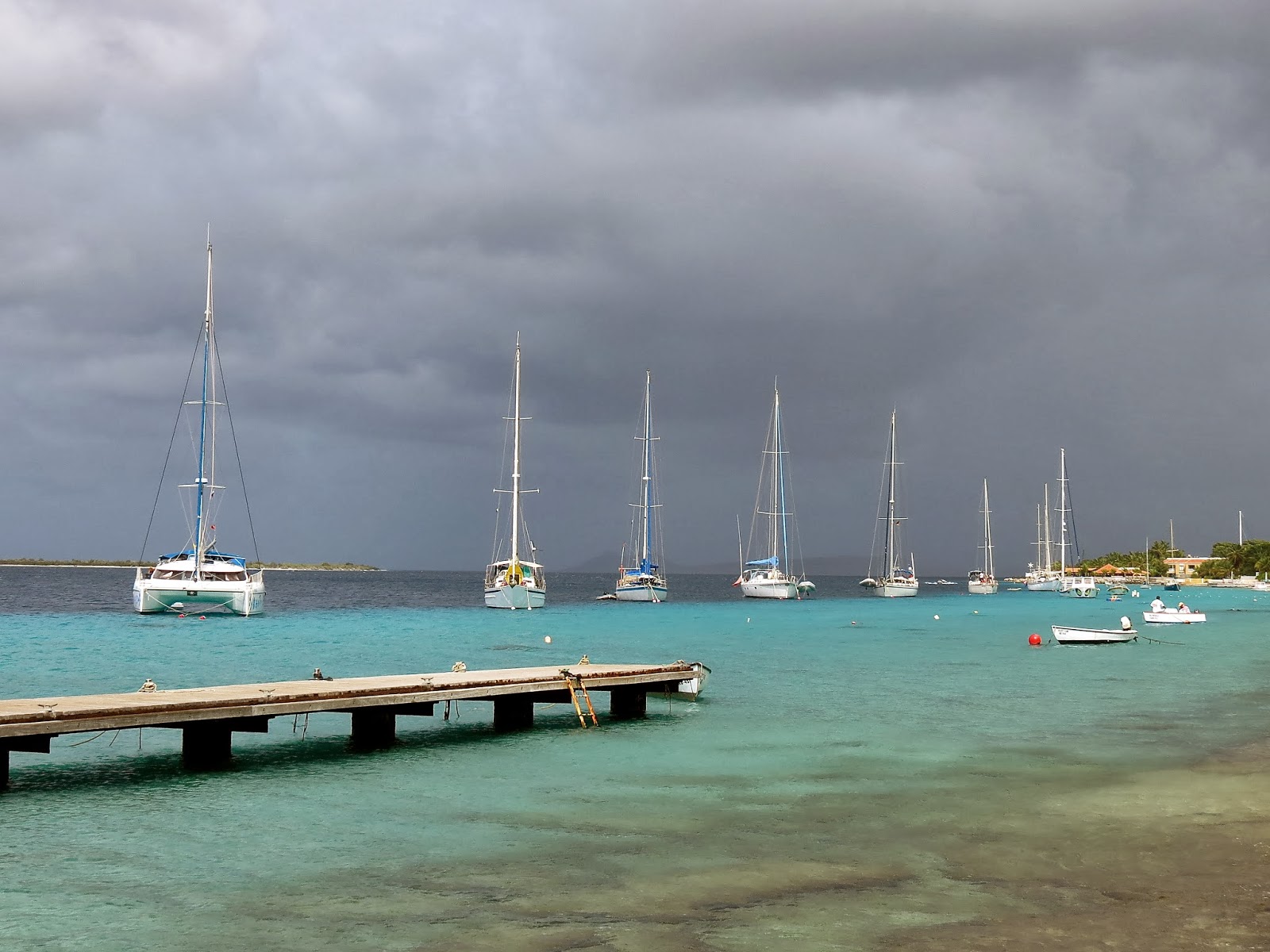
Tuesday, November 19, 2013
Arrival in Santa Marta Columbia
After a few days in Aruba we checked the weather and saw a change coming up. The winds have been strong the last few days and we could see it was starting to ease and then the wind was going to drop to very low for a few days. We did not want to motor the 255 miles to Santa Marta our next destination. So we decided to leave Saturday morning.
We cleared out with customs and immigration. We took a bus down and walked last bit, and then were going to walk back. I had asked the officials when we cleared in if we needed to bring our boat back to Bacadera to clear out and they said no. But while we were clearing out they asked where our boat was and that we were to bring the boat here to clear out. I was very annoyed at this and he relented and said okay but next time. It was very windy that day and it would be very difficult to go up against wind and waves to get to Bacadera. This alone could be a reason to skip visiting Aruba, for a small sailboat. The inside route is supposedly not safe if you don't know the area. On the walk back a car soon stopped and offered us a ride back to our dinghy, great.
We left at first light Saturday morning and started sailing soon after clearing the reef. The wind was lighter than the previous days but we still had lots of wind to sail along beautifully all day. We rounded the infamous Point Gillinas late in the night with no dramas and a full moon to light our way. We stayed about 7 to 10 miles off shore and did not notice any difficult sea conditions in the 20 to 23 knots of wind we were getting. We had to alter course 3 times to avoid ships. The AIS would tell us that a ships CPR or "closest point of approach" will be half a mile to Zero, it can't be exact as the yacht bounces around so much. So we would alter course a bit one way or the other to get the CPR to increase and then hold that course until the ship went by. Also saw a couple of what we thought were fish boats and steered around one. All this makes for a tiring night.
The next night we were crossing a huge bay and we stayed just inside the bay so all the ships passed to the North of our course. So we had a nice quiet night and also no fish boats but good sailing.
The wind eased around 3am and our boat speed slowed to 3.5 to 5 knots. With the arrival of dawn we were treated to a great view of the huge snow capped peaks of the Sierra Nevadas before the daily haze set in. Later in the morning with about 12 miles to go the wind picked up to 25 to 30knots. We figured this was a local condition being caused by the huge mountains. The strong wind stayed with us until we rounded the last major headland to get into Santa Marta. We motored the last 2 miles into Santa Marta as the winds died and came up on the nose. It was a great passage, with good sailing and no dramas.
I steered for the long fuel dock at the entrance to the marina and tied up there with the help of two employees on the dock. We were in Columbia our first time in South America, we would have to learn some Spanish! We were soon directed to a marina spot and were helped in with 4 smiling employees all very friendly and eager to help.
INFO
-We left at 5:30am Aruba for Santa Marta Columbia on Nov 16 2013. It is approx 255 miles
-On this passage we had a half to one knot of current with us up to and past Pt Gillinas then lost current and while crossing huge bay we thought we might have a half knot of current against us at times and then later no current.
We rounded Point Gallinas about 7 to 10 miles offshore in 20 to 23 knots of wind and had none of the reputed confused seas though it was dark, but with a full moon.
-Santa Marta marina could be gotten into at night I would think. Goto 11 14.65N 74 13.05W then to 11 14.72N 74 13.12W. The marina entrance WP is 11 14.633N 74 13.05W the fuel dock which is right in the entrance on your left can be seen on google earth. Tie up here until morning, It's waypoint is 11 14.554 74 13.049. We saw depths down to 12 feet on the way to fuel dock and this is just the last few hundred feet, the outside harbour is much deeper.
-The marina is a pleasant place, with free wifi ( it won't reach boat even with a booster) and a sitting area to use it.
There is laundry and a minimart and water and power. The showers are even have hot water! The marina staff are all helpful and friendly.
Wednesday, November 13, 2013
Aruba!!
After 10 days in Curacao we started looking at the weather as it was about time to move on. The weather show the winds to be getting much stronger in a couple of days so we decided to clear out the next day. Nov 9 Saturday we took the bus into Willemstad to clear out with immigration and then customs with the plan of leaving Sunday morning. After talking to other people who have done this trip before, we decided to just go up to and anchorage near end of island the first day and then do the last 50 miles in one long day which saves doing an over night passage.
Sunday morning we left about 7am for the 25 miles up to our anchorage. We got a radio call from the Mojombo's as we cleared the harbour. They had gone for a early morning walk to the top of a local hill past the old fort and could see us coming out. They were just tiny specs on the hill top, but with the binoculars could see them waving, a great send off. The wind picked up an hour later and we had a fast sail up the coast with the wind behind us. We sailed around the last headland and the seas flattened out into a beautiful anchorage. We dropped the hook in a bout 19 feet around 1pm and now could relax. We did some snorkeling along the South shore cliffs and it was pretty good. Lots of different fish. We did not go ashore as we were cleared out of the country. The only other yacht in here came over and said hello, he said occasionally the coast guard was coming into the bay to check boat papers, but we never saw them.
The next morning we were up at 02:15am and under way a few minutes later. The wind was up and we started sailing soon as we cleared the harbour. The 50 miles went quickly as the winds built up to 20 plus knots. The seas got fairly rough as we neared the half way mark of passage and I closed the cabin door for awhile. The seas eased a bit a couple hours later. About 8 miles out we could see Aruba through the haze and also see 10 huge wind turbines at the end of the island.
As we rounded the South end of island and started up the West coast the swells got smaller but the wind picked up and soon I put a third reef in main and had almost no head sail and we still went along at 6 knots. The wind was gusting to over 25 knots at times and occasionally over 30 knots. The entrance to Baradera soon came up and we motored through the pass to head for the dock to clear customs, right about noon time. Now we were going straight into the blasting wind and we suddenly going less than 2 knots. I increased throttle to keep us moving, there may have been some current as well.
It is mandatory to bring you boat into this harbour to clear in and we heard you may have to tie to a fish boat. Up ahead to the South we could see several hundred feet of empty wall ahead and headed for this. As we came closer we could see it was a cement wall lined with tires and about the height of our decks. The wind was blowing at an angle of the land but still heading us. We came along side slowly, heading for a large bollard we chose, and could see a man running up to take our lines. We should have had some big loops pre tied in our lines then we could have just thrown this over and quickly cleated line off. But instead we threw the line to the helper but by the time he tied the rope around the huge bollard, the wind had blow us off and we were 15 feet off the dock. We then threw the helper our stern line and he tied it to a tire chain, but the bow line was taking most of the force because of wind. Now we had both lines to shore but the boat was still 10 feet off the dock. The poor helper was trying to pull us in but it was almost impossible. Finally using the engine a bit and pulling we got close enough that I could jump of and go to customs.
I left Dorothy on the boat, but it turned out they wanted her there as well. But since she wasn't, they actually sent someone all the way down to our boat to get here to sign one of the forms and then return with it, very nice of them.
Forty five minutes later we left the wall and headed for the anchorage called the "Airport anchorage". It is a couple of miles further up the coast. We went back out the pass and let the wind blow us up to the entrance to the main town of Oranjestad. We motored inside and found only two other yachts here, great. We dropped anchor at a likely spot but moved a couple of hours later as we decided we were too close to the main channel and all the speed boats going by, so upped anchor and moved over a few hundred meters and re anchored. The whole time the wind is blowing 20 plus knots. But the holding is good and lots of room to move around.
The next morning a couple from the yacht in front of us came over to our boat and offered to take us into town shopping, as they had a hire car. We said sure as this looked like a good opportunity to learn a bit about the island and meet some nice people. As they headed back to their boat the motor died on their dinghy and in the strong wind they could not paddle to their boat, suddenly the man jumped in the water and was pulling his dinghy but not making much headway, then the lady dived in and they were both swimming, and not making much headway. Mean while we were frantically putting our dinghy together so we could go help them. Before we could get it into the water a dinghy from the only other yacht here, came over and helped them out. An hour later we had a nice little tour of the island and got some groceries at a large supermarket we stopped at.
There are lots of tourists around here, the most we have seen since Thailand.
We took a walk up to the Renassance marina area and looked at all the shops and generally explored. There is two cruise ships in and jumbo jets flying in every day.
There are lots of tourists around here, the most we have seen since Thailand.
We took a walk up to the Renassance marina area and looked at all the shops and generally explored. There is two cruise ships in and jumbo jets flying in every day.
INFO
-Entrance waypoint to Barcadera harbour for customs. 12 28.84N 70 00.62W and waypoint at dock is 12 28.77N 69 59.84W Read above writeup about entering Barcadera harbour.
-Entrance Waypoint for Airport anchorage and the town of Oranjestad and also Renassance Marina is 12 30.48N 70 02.28W We anchored in 13 feet at 12 30. 53N 70 01.99W early we had anchored a few hundred feet over in 19 feet. But like this spot better.
-When going up from Barcadera and customs to Airport anchorage, people and some guide books say you can go inside the reef rather than go outside. The latest we got from the yacht who drove us around the island and they have been here several months. Is go up the outside, sands have been shifting and the bit just after Bacadera is very shallow and need local knowledge. After that the channel is okay. They said all the yachts go up the outside now.
The sands have been shifting a bit in the Airport anchorage as well so move about carefully as some parts are too shallow now for a 7ft draft.
- For a dinghy dock we have been using the small dive boats dinghy dock just across from us. We heard you can use Renaissance marina but they charge?? We found a medium size grocery store a 25 minute walk up from our dinghy dock it is in the main town near the waterfront mall. The bigger ones you can take a bus to.
-Customs and Immigration is open 7 days a week 6am to 6pm and customs 24 hours. They told us you do not need to take your boat back up to Barcadera to clear out, you can dinghy up or take bus and walk. But after going to clear out we were told by another official that we must bring our boat up to clear out?? He let it go this time he said but next time must bring boat up, so I guess it depends who you talk to. I would skip Aruba if I knew I had to bring my boat back against the wind we had, just to check out.
-There is a small fairly well stocked chandlry which is also the Renassance marina office just South of the marina, the other side of a plaza along with a strip of small stores.
-We found free wifi in the plaza between the marina office and the marina along with some seating. Its called "Plaza free Wifi".
Is beside the Dutch Panacake cafe.
Saturday, November 9, 2013


Wednesday, November 6, 2013


Off to Curacao
Our second to last day in Bonaire we rented a golf cart and joined Mojombo family on a self guided tour of the island. We saw the wind farm at the North end of island where the island gets about 30% of its electricity. There is also a huge oil transfer facility up here where Venezualan oil is reshipped to larger ships as there is no deep water ports in Venezuela. Then the last day we went for a snorkel again with the Mojombo's for the morning over at the island of Kline Bonaire with our dinghies. The South end of this island probably has the best snorkeling we have seen on Bonaire. Then in the afternoon we cleared out with customs and immigration for Curacao, and got the boat ready for a short ocean passage.
We left just after 5:30am next morning to do the 35 miles to Curacao, the C in the ABC islands. We had a slower passage than we thought it would be as the winds did not fill in as strong as predicted. But we still arrived a bit before 2pm with a couple of hours of motoring at each end of he passage. Four squalls went by us but only one grazed us with a few minutes of rain and a bit more wind.
As we came around the bottom end of Curacao the swells eased and we had a smooth motor up to the entrance to Spanish Waters where we planned to anchor. The channel is narrow but easy to navigate.mainly just staying in the center and the chart plotter seemed bang on. The place is full of yachts and most seemed to be Dutch. We found a spot to anchor in A anchorage area though we suspect we are a bit out of bounds along with a couple of other yachts. As soon as our anchor was down a big rain squall came through with about 20 knots of wind to test our holding. The holding was good.
Curacao is a bigger island with over a 100,000 people on it and is much busier than Bonaire. After a day here we were sort of missing the quiet life at Bonaire. But it is okay here and more to do as well, though to takes more work to do it. The day we arrived we took the bus into Willemstad to clear with customs and immigration. The town is pretty with lots of colorful buildings and interesting shops. We did not get back to the boat until after dark as it is a bit slow dealing with the two offices and the buses only run every hour.
The last 3 days since we've been here have been cooler than Bonaire and we have had a lot more rain. Today it rained off and on all day and a lot of rain last night. We also found a nice place for walking, away from the traffic. If you go left instead of right when coming out of the fishermen's dock, you can have a nice walk down to the point where there is a old fort. You also go by a a good beach on the way. It is an interesting walk through the fort and no fees for a change. We found out later that Bonaire also had a huge amount of rain the same time we were getting it here.
INFO
-We anchored at 12 04.82N 68 51.78W in 18 feet of water.
-We noticed that the Free Cruising Guide to the ABC's (downloaded off Internet) has the C and D anchorages reversed from what the port captain map shows.
-The Spanish Waters anchorage was pretty full when we arrived Oct 30. But still holes here and there. Anchorage C (or D in cruising guide) had more room with only 2 boats in it, but still not a unreasonable dinghy ride in.
-It took us a couple of days here to get orientated as there is little info for cruiser's out there ad the free guide is limited though it does help.
-To go to customs and immigration. From the dinghy dock at fishermans dock (waypoint 12 04.76N 68 51.96W) Do a 3 or 4 minute walk up to a small traffic circle to the bus stop (bushalte sign). The bus, like everywhere here , takes US dollars or Guilders. Take the bus right into Willemstad Punta area and stay on bus to the end of it's run which is the bus terminal. This is also where you catch the bus back. Bus is 6A or Caracus Baai bus and this is bus you take there and back. The Free cruising guide shows where the two offices are, and port captain is right beside immigration. Note, the customs building has no sign on the door saying what it is, just go in. It is the last building along the waterway before you hit the other channel. The building does say custom at very top of building in huge letters, but we did not see that until we were on the other side of channel walking to immigration. It is about a 20 minute walk from customs to immigration ( no whining it's not quite your mder or minimum daily exercise requirement).
Note the 6A bus between Spanish Waters and Willemstad only goes every hour to hour and a half depending on time of day. Fare is about $1.00US and can get a schedule at booth at bus terminal. The only fees we had to pay was a one time $10 anchoring fee to port captain.
-There is a free shuttle bus every day except Sunday to a large grocery store about a 15 minute ride away. It leaves from the fisherman's dinghy dock at 10am every morning. The Budget marine and Island marine stores are only a few minutes walk away from this grocery store. You get one hour to shop before bus heads back. This grocery store is very good with best selection of goods anywhere we have seen.
-There is a currently a cruisers net on VHF72 at 7:45am every day except Sunday.
-There is a waterboat that will deliver water to your boat every Wednesday , but call him up on Monday or Tues on 72.
Tuesday, November 5, 2013


Subscribe to:
Posts (Atom)

